LiDAR Surveying

At AirOne Robotics we use advanced drone-mounted LiDAR systems to deliver accurate 3D terrain models, point-clouds and survey data faster, safer and more cost-effectively than conventional methods. Whether you’re mapping land, inspecting infrastructure or conducting terrain modelling, our LiDAR-drone services bring the next generation of surveying to your project site.

Get a quote:

Drone Services Form

What is LiDAR Surveying?

LiDAR (Light Detection and Ranging) is a remote-sensing method that uses pulsed laser light to measure distances to the Earth. When mounted on drones (UAVs), LiDAR enables high-resolution terrain mapping, accurate elevation models, and detailed point-cloud generation — even in complex environments.

Unlike traditional ground-surveying or photogrammetry alone, drone-LiDAR penetrates vegetation, captures bare-earth surfaces, and delivers millimetre-to-centimetre accuracy across large areas with speed and efficiency. For industries such as civil engineering, mining, infrastructure, forestry and agriculture, LiDAR surveying is transforming how data is collected and analysed.

Key Benefits & Capabilities

Speed & Efficiency

Drone-based LiDAR drastically reduces field time compared to traditional ground survey, speeding up data collection, revisits and project delivery.

High Accuracy

Pin-point accuracy in 3D measurement, delivering reliable spatial data for engineering and decision-making.

Cost-effectiveness

Reduced manpower, fewer ground control points, less time on site mean considerable cost savings compared to legacy survey methods.

Safe Access

Difficult or hazardous terrain? Drone operation keeps personnel safe while reaching places ground teams might struggle to access.

Actionable Deliverables

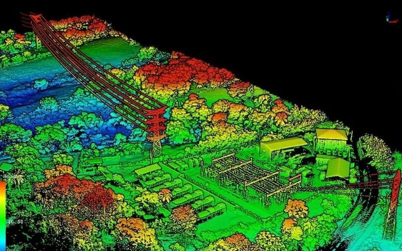
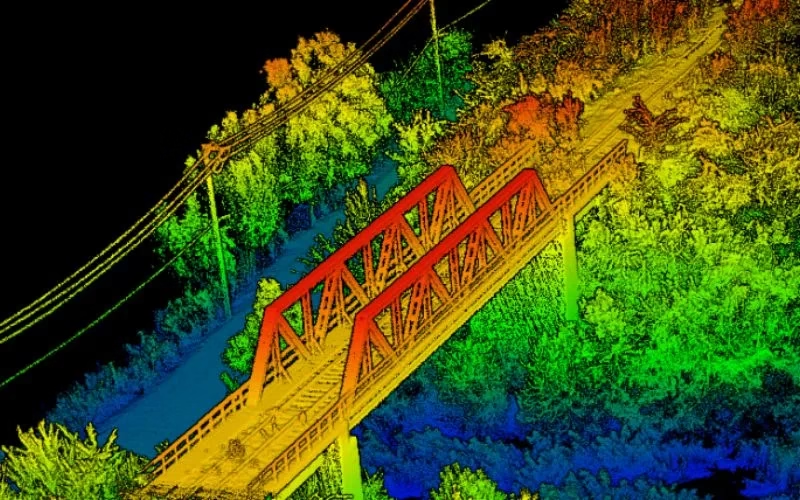
We deliver cleaned point-clouds, classified ground/vegetation layers, DEM/DSM, contours, cross-sections, volume calculations — ready for your GIS, CAD or BIM workflows.

Why Choose AirOne Robotics?

Specialist LiDAR + Drone Expertise

We combine state-of-the-art LiDAR sensors with UAV platforms optimised for surveying missions. Our team is skilled in mission planning, flight execution, data processing and output generation — delivering end-to-end service.

Tailored for Indian Terrain & Conditions

Based in India, we understand local landscape, monsoon/flood-zones, topography, regulatory environment and project constraints. We’re well-equipped to deploy in remote, challenging or large-scale sites across the subcontinent.

Quality & Compliance

Our workflows adhere to survey industry standards, ensuring data you can trust. We apply rigorous quality-control (QA/QC) and deliver consistently.

Rapid Mobilization

We can deploy quickly, with minimal ground disruption. From site reconnaissance to flight to deliverables, our turnaround is fast and efficient.

Versatility Across Industries

Whether it’s infrastructure, mining, agriculture or forestry, our LiDAR solutions adapt to your needs — providing actionable insight for your domain.

Partner-Led Approach

We don’t just supply data — we work with you to interpret results, integrate into your workflow and support decision-making. Your success is our mission.

Technical Workflow & Deliverables

Project Scoping & Site Reconnaissance
We assess terrain, site access, regulatory permissions, flight planning.
Mission Planning
Flight lines, sensor set-up, control points, safety protocols, regulatory compliance.
Data Acquisition
Using our UAV + LiDAR sensor system, we collect raw point‐clouds, ground control, RTK/PPK data as required.
Data Processing & Classification
Raw data is cleaned, classified (ground, vegetation, built form), filtered and converted into deliverables.
Deliverables Delivery

We supply you with:

  • Classified point-cloud (LAS/LAZ)

  • DEM/DSM

  • Contour maps (2D/3D)

  • Volume & cross-section reports

  • GIS/CAD/BIM ready files (shapefiles, DXF, DWG)

  • Insight report summarising findings and recommendations

Support & Integration
Post-delivery we support you with integration into your system, interpretation of results, and any assistance you need.