
Urban Air Quality Monitoring
Drone Surveillance determines high-traffic locations and pollution hotspots by assessing the pollution levels in urban areas.

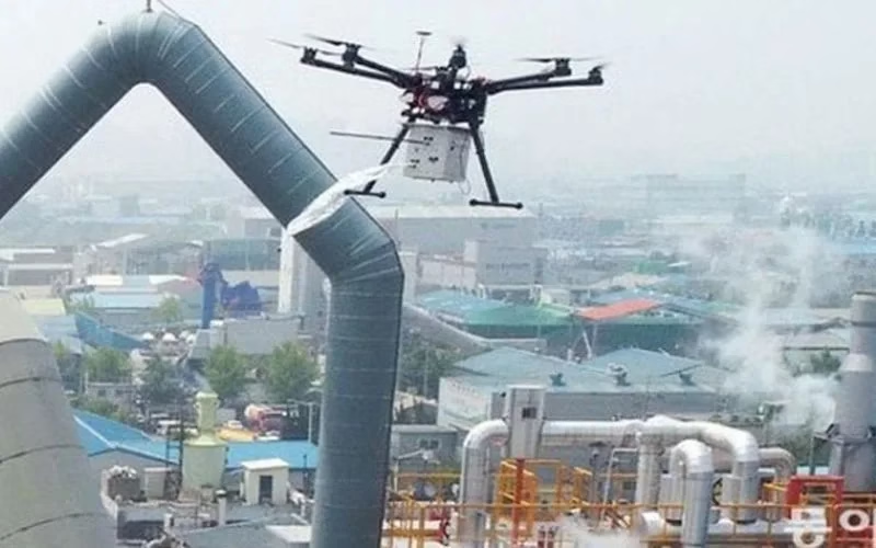
Industrial Emissions Monitoring
Drone Surveillance monitors emissions from manufacturing plants and other industrial establishments. To guarantee adherence to environmental standards, report emissions.

Environmental Impact Assessments
Drone Surveillance also analyzes how construction projects affect local air quality. Evaluate the effects of changing land use on the quality of the air. Examine how natural disasters affect air quality.

Disaster Response
Quickly evaluate air quality following incidents such as chemical spills. After industrial accidents or wildfires, evaluate the air quality. Utilize the information to guide emergency response activities.

Agricultural Emissions Tracking
Monitor how agricultural activities affect local air quality. Monitor how the usage of pesticides affects the quality of the air. Examine how fertilizer use affects the quality of the air.

Research And Data Collection
By collecting data, you may support scientific studies on air pollution. Make contributions to research on atmospheric conditions and climate change.

Specialist LiDAR + Drone Expertise
We combine state-of-the-art LiDAR sensors with UAV platforms optimised for surveying missions. Our team is skilled in mission planning, flight execution, data processing and output generation — delivering end-to-end service.

Tailored for Indian Terrain & Conditions
Based in India, we understand local landscape, monsoon/flood-zones, topography, regulatory environment and project constraints. We’re well-equipped to deploy in remote, challenging or large-scale sites across the subcontinent.
Quality & Compliance
Our workflows adhere to survey industry standards, ensuring data you can trust. We apply rigorous quality-control (QA/QC) and deliver consistently.

Rapid Mobilization
We can deploy quickly, with minimal ground disruption. From site reconnaissance to flight to deliverables, our turnaround is fast and efficient.

Versatility Across Industries
Whether it’s infrastructure, mining, agriculture or forestry, our LiDAR solutions adapt to your needs — providing actionable insight for your domain.
Partner-Led Approach
We don’t just supply data — we work with you to interpret results, integrate into your workflow and support decision-making. Your success is our mission.


