River Bank Mapping
Welcome to a whole new world of riverbank mapping! Powered by advanced Drone For Surveying technology, we’re revolutionizing the way riverbanks are surveyed, analyzed, and monitored. From environmental studies to flood risk assessments and infrastructure inspections, our Survey Drones provide fast, accurate, and reliable data that leaves traditional methods in the dust. Imagine seeing your riverbanks in stunning detail, with every curve, bend, and potential hazard mapped out. Ready to take your Drone For Surveying to the next level? We’re here to make it happen—precise, powerful, and prepared for anything!
Get a Quote
What Is River Bank Mapping
River Bank Mapping by Survey Drone is a groundbreaking technique that utilizes unmanned aerial vehicles (UAVs) to capture high-resolution imagery and precise data on riverbanks. Drone For Surveying offers a comprehensive and accurate assessment of river environments, enabling professionals to monitor erosion, track changes in the landscape, and analyze flood risks with unmatched efficiency. By combining advanced Survey Drones with sophisticated mapping tools, it provides real-time, detailed insights that were once time-consuming and labor-intensive to obtain, transforming environmental monitoring and management.
Applications Of River Bank Mapping With Drones
The applications of drone technology in river bank mapping are as diverse as the ecosystems they study:

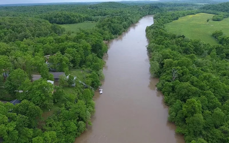
Environmental Monitoring
Drone For Surveying acts as watchful sentinels. They track riverbank conditions in real-time. These instruments capture the slightest changes in erosion and sediment deposition. Additionally, Survey Drone records changes to the habitat. This information is essential for evaluating our ecosystems' general health.

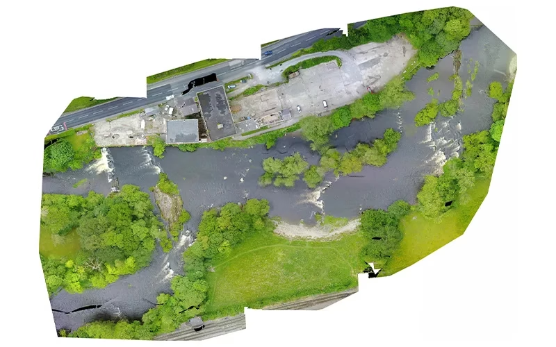
Infrastructure Inspection
Bridges, dams, and other important structures can be skillfully avoided using Drone For Surveying. They soar over and next to these buildings along the shores of rivers. This capability enables timely maintenance and inspections. It guarantees the preservation of structural integrity and safety.

Land Use Planning
Urban planners and land managers benefit immensely from Survey Drones. Drones provide a comprehensive overview of current land use patterns. This information is instrumental in promoting sustainable development. It also supports responsible resource management.
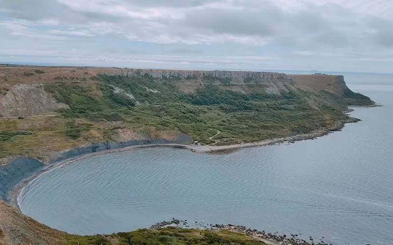
Ecological Research
Drone For Surveying provides a view from above. They make it easier to conduct in-depth research on wildlife habitats and biodiversity along riverbanks. The information acquired is essential to conservation initiatives. It gives researchers the information they need. This knowledge aids in the preservation of delicate species and their environments.

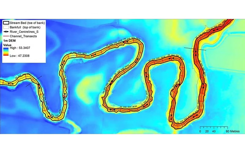
Flood Risk Assessment
Survey Drones assess bank stability and examine the morphology of rivers. They can identify areas at risk of flooding. This knowledge is priceless. It gives communities the ability to improve their preparedness plans for disasters. It also aids in the development of successful mitigation strategies.
Deliverable Outputs Of River Bank Mapping With Drones
The outputs generated from drone river bank mapping are both diverse and highly valuable:
Drones capture beautiful, high-resolution photos and films. These display riverbanks and the area around them. The pictures are a visual feast for interpretation.
Drone Survey Mapping crafts detailed elevation models and contour maps from data. These reveal nuanced changes in terrain. They enhance our understanding of physical landscapes.
These three-dimensional representations are captivating. They provide a comprehensive spatial analysis of the riverbank environment. They enable stakeholders to visualize changes. The representations show the changes with remarkable clarity.
Comprehensive summaries detail the findings. They include critical analyses of erosion rates, habitat conditions, and other significant metrics. These summaries present a clear picture of riverbank dynamics.
Geographic Information System (GIS) files empower further spatial analysis. They allow for the seamless integration of drone data with other datasets. This integration is essential for informed planning and management.