Filter by brand

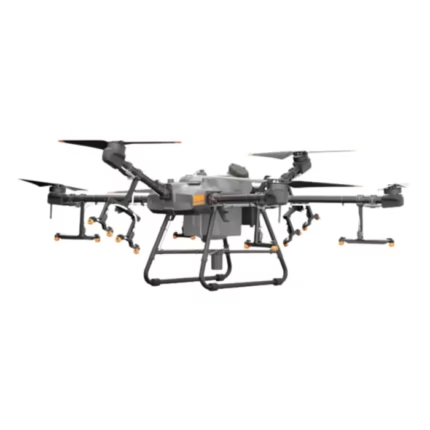
DJI Agras T30
In stock
- Hourly work efficiency: 40 acres
- One-button air discharge system
- Removable batteries for easy replacement
- Single remote control for up to three drones
- D-RTK technology for enhanced positioning accuracy
- Top-view radar module for additional obstacle detection
- Flight laser function for precision flight control
- Intelligent endurance/return function
- Intelligent supply-point prediction
- Branch targeting technology
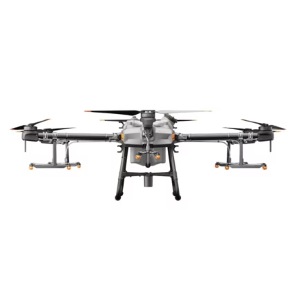
DJI Agras T25
In stock
₹1,415,000.00- Handles agricultural tasks like spraying pesticides, herbicides, and fertilisers.
- Excels in both spraying and spreading operations on farmlands.
- GNSS and RTK technology for superior hovering accuracy and flight stability.
- Advanced obstacle avoidance and phased array radar for 360° sensing.
- User-friendly remote controller with 7.02-inch LCD touchscreen.
- Intelligent flight battery and efficient charging system for minimal downtime.
- Lightweight and easy to handle by one person.
- Compact design with robust performance.
- Ideal for crop protection, pest control, and fertilisation.
- Compatible with various spreading materials.
- Offers advanced features and robust performance at a competitive price.
- Suitable for large and small-scale farming operations.
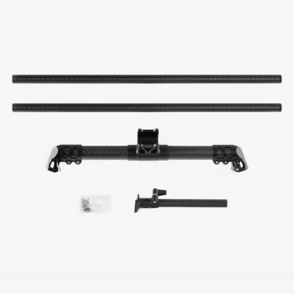
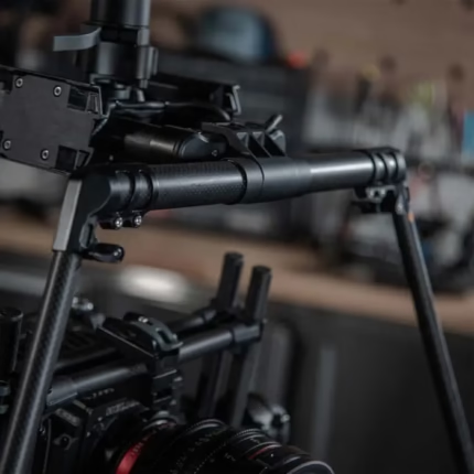
Freefly Mōvi Pro Gimbal Landing Gear
In stock
Introducing the Freefly Movi Pro Gimbal Landing Gear – the perfect companion for expanding your creative horizons in the world of cinematography. Whether you’re a seasoned professional or an aspiring filmmaker, the Freefly Movi Pro Gimbal Landing Gear is a game-changer, elevating your cinematography to new heights. Unleash your creativity and capture breathtaking shots with the confidence that comes from using top-tier equipment.
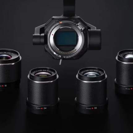
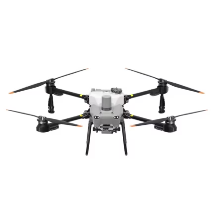
DJI Mavic 3 Multispectral
In stock
₹509,000.00Technical Specifications :
Net Weight (with propellers and RTK module): 951 g
Max Takeoff Weight: 1,050 g
Dimensions (Folded): 223×96.3×122.2 mm (Length×Width×Height)
Dimensions (Unfolded): 347.5×283×139.6 mm (Length×Width×Height)
Diagonal Length: 380.1 mm
Max Ascent Speed: 6 m/s (Normal Mode), 8 m/s (Sport Mode)
Max Descent Speed: 6 m/s (Normal Mode), 6 m/s (Sport Mode)
Max Flight Speed (at sea level, no wind): 15 m/s (Normal Mode), 21 m/s (Sport Mode – forward), 20 m/s (sideways), 19 m/s (backwards)
Max Wind Speed Resistance: 12 m/s
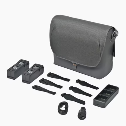
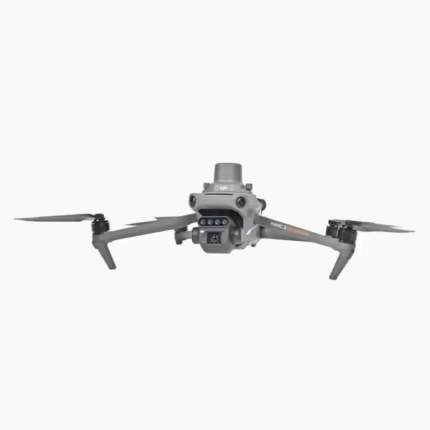
DJI Mavic 3 Fly More Combo Kit
In stock
₹61,360.00What’s Included:
- DJI Mavic 3 Intelligent Flight Batteries × 2
- DJI Mavic 3 100W Battery Charging Hub × 1
- DJI 65W Car Charger × 1
- DJI Mavic 3 Low-Noise Propellers (Pair) × 3
- DJI Convertible Carrying Bag × 1
And many more…

JIYI Obstacle Radar Sensor Back for Agricultural Sprayer Drones UAV
In stock


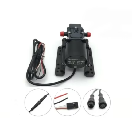
Hobbywing 5L Brushless Water Pump and Spray System with Pressure Nozzles for Agricultural Drone
In stock
- Operating voltage: 12-14S (DC44-60.9V)
- Working current: <2A
- Weight: 388g (about 338 g without wire)
- water inlet diameter: 10.5mm
- water outlet diameter : 6.5mm
- Amount power: 60W
- Opening flow: 5L/min
- Size: 123*76*52mm
- Working pressure: 0.35Mpa
- Protection level: IP67
- Fixed PWM throttle stroke: 110-1940US
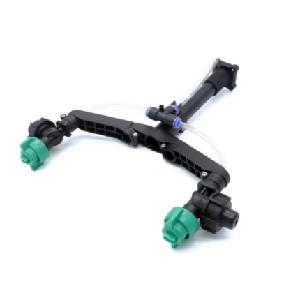
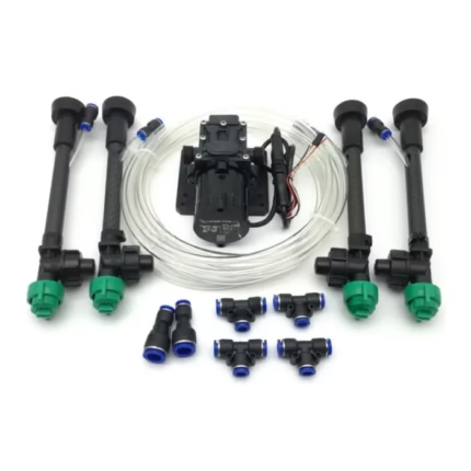
EFT Y Shaped High Pressure Nozzles for Agriculture Drone MOQ 4 Pcs
In stock
- 4 x EFT Y Shaped Extended High Pressure Nozzles for Agriculture Drone
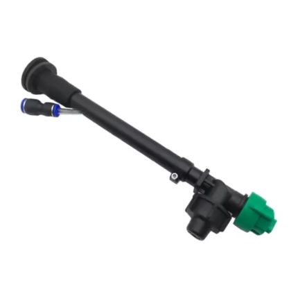
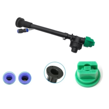
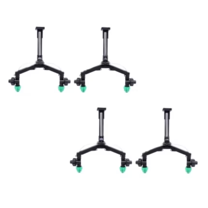
EFT Extension Rod High Pressure Nozzles for Agriculture Drone MOQ 4 Pcs
In stock
The rod pressure nozzle has a 180mm downward extension that successfully prevents the droplet from moving. The quick-release pneumatic joint is designed to enter and draw out water pipes with an outer width of 6mm, making assembly simple. The nozzle is made of high-strength nylon, which has a high strength, is not easily blocked, the drops are small, and the atomization is consistent, significantly improving pesticide application.
The nozzle is made of high-strength nylon, which has a high strength, is not easily blocked, the drops are small, and the atomization is consistent, significantly improving pesticide application.
Hobbywing 8L Brushless Water Pump and Spray System with Pressure Nozzles for Agricultural Drone
In stock
Hobbywing 8L Brushless Water Pump Specifications:
- Operating voltage: 12-14S (DC44-60.9V)
- Working current: <2A
- Weight: 685g
- water inlet diameter: 10.5mm
- water outlet diameter : 6.5mm
- Amount power: 60W
- Opening flow: 8L/min
- Size: 140*95*70mm
- Working pressure: 0.5Mpa
- Protection level: IP67
- Fixed PWM throttle stroke: 110-1940US


